George Town World Heritage Site
This map illustrates the general land use of George Town surveyed by Majlis Perbandaran Pulau Pinang (MBPP) building use of George Town World Heritage Site (GTWHS) surveyed by Think City .
Significant Trends and Key Insights
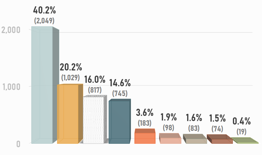
Building Use in 2013


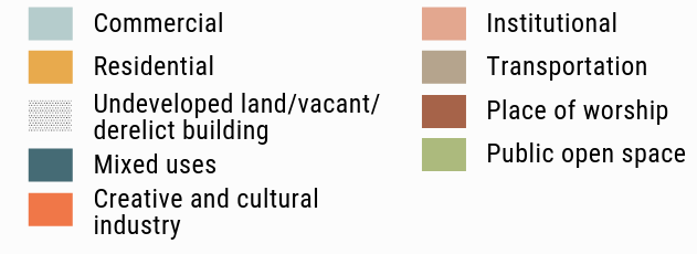
► The built environment in GTWHS is dominated by commercial use making up to 40.2% of the site while use for public open spaces or green spaces is at an underwhelming 0.4%.
Sources
Think City; GTWHS Population and Land Use Census, 2013;
Majlis Perbandaran Pulau Pinang; Land Use, 2016;
Aga Khan Trust for Culture & Think City; George Town Strategic Master Plan, 2014
Think City has undertaken a third census in 2019. The data collection of George Town World Heritage Site Population and Land Use Census 2019 is completed. The findings will be shared once the report is finalised.
Next ▶ Demographics of GTWHS (Employment)

George Town World Heritage Site
Building use of GTWHS.